
The internet has upended many trades. Next, perhaps, will be census takers. A new study finds that Google’s “Street View” photographs can be used to estimate a neighborhood’s racial fabric. They can also correctly predict if a town will vote Democrat or Republican over 80 percent of the time.
Traditionally, the Census Bureau collects exhaustive population surveys once a decade and a smaller sample — the American Community Survey (ACS) — once a year. But car-mounted cameras that automatically shoot photos to feed Google’s Maps application are as accurate at predicting demographics as the ACS sample, researchers led by Stanford computer scientist Timnit Gebru write in the Proceedings of the National Academy of Sciences.
Google also makes this work much less labor-intensive.
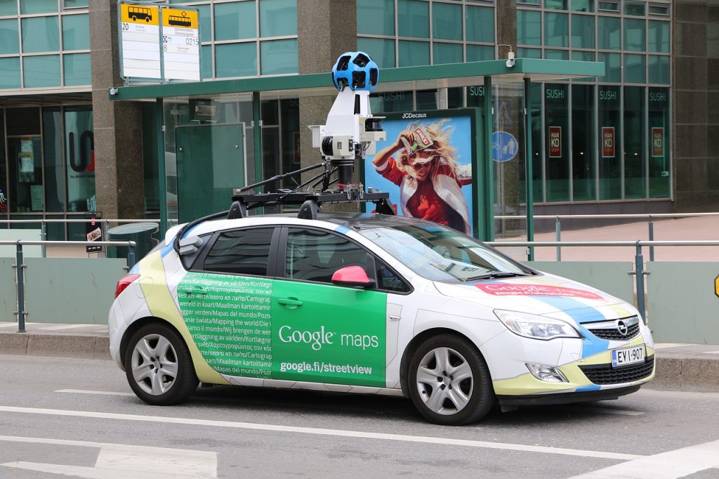
Using a type of artificial intelligence known as “convolutional neural networks,” the authors teach computers to recognize different vehicle features — including make, model, year, average price and fuel efficiency — and classify them into 2,657 categories. In two weeks, their computers crunched through 50 million images shot in over 3,000 ZIP codes in 200 towns and cities across the United States. The same task would take a human 15 years.
From these categories, the researchers “infer a wide range of demographic statistics, socioeconomic attributes, and political preferences.” Vehicles are “among the most personalized expressions of American culture,” Gebru and her team write. About 95 percent of American households own one.
To judge the accuracy of their findings, they then compare their inferences to presidential election returns from 2008 and ACS data: “We found a strong correlation between our results and ACS values for every demographic statistic we examined.”
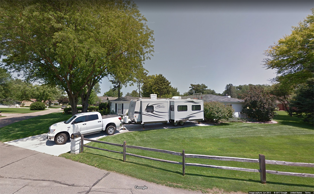
- Hondas and Toyotas most strongly indicate an Asian neighborhood.
- Chryslers, Buicks and Oldsmobiles “are positively associated with African-American neighborhoods.”
- Pickup trucks and Volkswagens are associated with white neighborhoods.
- Sedans are most associated with Democratic voter precincts; Republican-leaning precincts are most associated with extended-cab pickup trucks.
- If there are more sedans in a precinct, there is an 88 percent chance it voted Democrat; if there are more pickups, there is an 82 percent chance it voted Republican.
- “We found a strong correlation between our results and ACS values for every demographic statistic we examined.”
- The method has limitations: The researchers were not able to infer the percentage of children or farmers in a neighborhood.
Gebru and her colleagues write that this technology soon could have broader potential, as self-driving cars hit the roads, increasing the frequency of surveying trips: “The emergence of self-driving cars will bring about a large increase in the frequency with which different locations are sampled.”